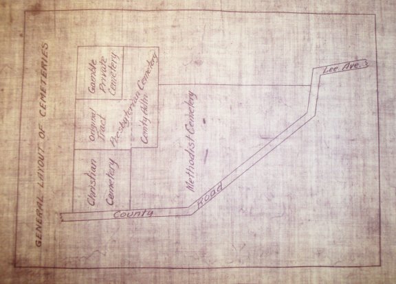
Gamel cemetery is located north of Hwy. A on Lee Avenue in Festus, Jefferson County, Missouri. Although it is now usually referred to as Gamel Cemetery, it actually consists of four separate cemeteries; the Gamel Family Cemetery, Festus Methodist Church Cemetery, Festus Presbyterian Church Cemetery, and the Festus Christian Church Cemetery. The following plat map is on file at the Festus library showing the location of the four cemeteries. The existing roads through the cemetery are not an indication of the dividing lines of the four sections. The Gamel family plot (Gamble as noted on map) is enclosed by a fence.
Notes:
The original tract for the Festus Presbyterian Church Cemetery was surveyed and mapped by J.B. Dover, County Surveyor, in 1886. The cemetery addition was surveyed and mapped by John Hurtgen, County Surveyor in 1906.
The Festus Methodist Church cemetery plot was measured block by block in 1947 by Ed Rose and Howard Litton. They used the original ledger book and checked the grave markers one by one. It is not known to me where the original ledger book is now. A drawing was made of the cemetery at this time and the plot owners documented. This project was finished Nov. 26, 1947.